The Land Of Eastern Nembe Also Known As Opu-Nembe Or Nembe (Bassambiri) — Ebi Dressman
Talking about Eastern Nembe geographically, its shares boundary with the people of Bille and some Kalabari communities in the east, the Ogbia people in the north-west, Odual (Saka) people in the north-east. The southern boundary happens to be the great Atlantic ocean.
In the area of vegetation, the land is composed of green vegetation, an area of sandy beaches and ridges with rainforest vegetation along the coastal line, followed by an area of tidal creeks and mangrove swamps. The northern part of Eastern Nembe is also blessed with rainforest vegetation but slightly richer in rainfall than the former.
The rivers and creeks are mostly accessable, and the people had the dugout canoes as their major means of transportation before the advent of modern day river-crafts. The area is crisscrossed by a maze of rivers, rivulets, creeks and creeklet, and the major ones are the; San Bartholomew river, Santa Barbara river, and parts of the St. Nicholas river with their tributaries.
Eastern Nembe or Opu-Nembe is also endowed with many natural lakes, ponds, mudflats (a level tract lying at little depth below the surface of water or alternately covered and left bare by the tide) and islands. The most popular and celebrated mudflats according to Prof Atei Mark Okorobia (A Professor of History) are those in Ikensi, Iseleogono, Biokponga, Atubo, Obiata and Eyenmama satelite communities, all in Opu-Nembe. While some of the most striking and beautiful islands are Okipiri and Onyomapiri, all in the Eastern Nembe land.
THE CLIMATE ZONE
The climate of the area is marked by two lovely seasons; the Rainy and Dry seasons. The rainy season usually lasts from April to October, while that of the dry season kicks off in November and ends in March.
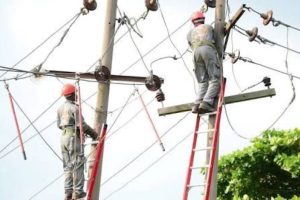
The deltaic nature of the environment influences and sometimes dictates the economic conditions of the inhabitants. For instance, before the destruction of the rivers, creeks, lakes and ponds by oil exploration activities, the economic life of the average Nembe man is predominantly fishing, salt making, local crafts and trading. It is the effective exploitation of the environment by the Nembe man that led them to success in building the ancient United Nembe City-State which attracted the European adventurers and their supercargoes into this area in the 15th century AD. (Prof Atei Mark Okorobia)
THE SOCIO-ECONOMIC FACTOR
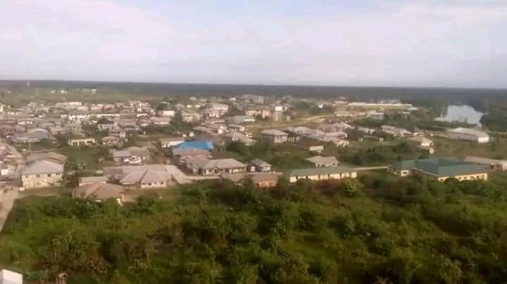
Geographically, the Eastern Nembe happens to be one of the single largest subgroup in Ijaw land. Eastern Nembe has more than 100,000 population with over 60 communities, 7 political wards and 2 state constituencies. This is one single reason why political power seekers see Opu-Nembe for who she truly is and is seen as the real ‘democratic power house’ and the ‘beautiful political bride’ of the Nembe speaking people and Bayelsa state at large. General elections are hardly won without the visible support of this land and people of Eastern Nembe. This can also be seen in the recent general elections in 2019.
This area has experienced several human activities. During the early time, the economy in this area was predominantly fishing, salt making, farming and trading activities. This was followed by the era of the Trans-Atlantic trade in slaves, and later in legitimate agricultural trade. The petroleum trade which is the dominant and main stay of Nigeria economy began in 1956 at Itokopiri-Otabagi in the Oloibiri clan of Ogbia nation state (Prof Atei Mark Okorobia) very close to the Northern boundary between Nembe and Ogbia.
Over the time, Eastern Nembe or Opu-Nembe has come to be a host community or impacted by oil activities. Such oil fields includes;
The Oluasiri oil field, which was erroneously nick-named Soku oil field or Soku gas plant by SPDC, with 6 oil wells and about 1million barrels of oil production, and 14million gas production.
Odeama creek oil field, which has 4 oil wells with 500,000 barrels of oil production and 600,000 gas production.
Belema and Belema North oil fields, Belema has 11 oil wells with 800,000 barrels of oil production and 700,000 gas production.
Ekulema 1 & 2 oil fields. Ekulema 1 with 8 oil wells with 400,000 barrels of oil production and 500,000 gas production.
Santa Barbara (Bassambiri) oil field has 2 oil wells with 200,000 barrels of oil production and 600,000 of gas production.
Santa Barbara South oil field has just 1 oil well with 80,000 barrels of oil production and 21,000 of gas production.
The Tora Manifold which controls the flow of oil in the whole of Bayelsa state and some parts of Rivers and Delta states is located in the heart of Eastern Nembe.
Eastern Nembe is also highly blessed with natural gas. According to reports, about 3/5th of the natural gas used by the Nigeria Liquefied Natural Gas project in Bonny, Rivers state is taken from the Oluasiri Gas Plant and other gas fields in Opu-Nembe.
With all these, you can agree with me that Easter Nembe or Opu-Nembe is truly endowed with the finest natural resources.
Long Live The Land Of Opu-Nembe!
Long Live The People Of Opu-Nembe!!
This article was originally written by Ebi Dressman